File:India - administrative map.png
Jump to navigation
Jump to search

Size of this preview: 514 × 600 pixels. Other resolutions: 206 × 240 pixels | 411 × 480 pixels | 658 × 768 pixels | 878 × 1,024 pixels | 1,487 × 1,735 pixels.
Original file (1,487 × 1,735 pixels, file size: 373 KB, MIME type: image/png)
| Description |
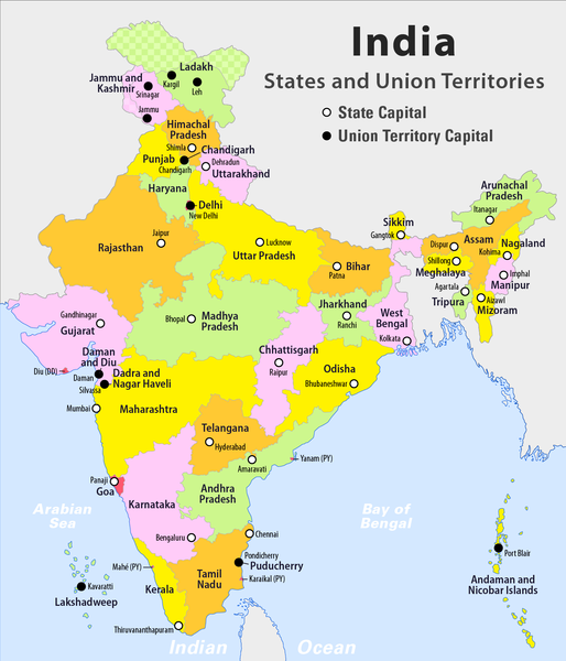
English: Administrative Map of India with States an Union Territories
Deutsch: Administrative Karte von Indien mit Bundesstaaten und Unionsterritorien |
| Date | see file history |
| Source | Own work |
| Author | Maximilian Dörrbecker (Chumwa) |
| Permission (Reusing this file) |
I, the copyright holder of this work, hereby publish it under the following license: This file is licensed under the Creative Commons Attribution-Share Alike 2.5 Generic license.
|
| Other versions |
|


File history
Click on a date/time to view the file as it appeared at that time.
| Date/Time | Thumbnail | Dimensions | User | Comment | |
|---|---|---|---|---|---|
| current | 22:39, 18 January 2020 | | 1,487 × 1,735 (373 KB) | wikimediacommons>Chumwa | + Ladakh |
File usage
The following page uses this file:
Global file usage
The following other wikis use this file:
- Usage on wiki.candelabrem.com

